
VP21 - Zamora - Montamarta - 18,5 km
Distance19 Km.Related packages
Camino de Santiago: Stage towards Montamarta
Leaving Zamora: Route towards Roales del Pan
From Zamora, we head towards Cuesta de la Morana, in the direction of the N-630. From there, we take a path that starts on the road to La Hiniesta. We continue our journey until we reach Roales del Pan, located about 6 kilometers away. Once in Roales, we leave the village and take a track parallel to the N-630, which will lead us to Montamarta.
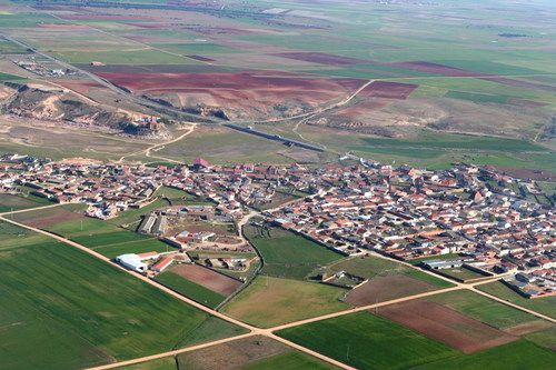
Montamarta: A Quiet Village on the Camino de Santiago
Information about Montamarta
Montamarta, at an altitude of 690 meters, is a picturesque village of 625 inhabitants located by the Esla River reservoir. This small town, also known as the “village of the storks,” is characterized by its tranquility and natural surroundings. It is a perfect place to enjoy local gastronomy, based on handmade and traditional foods.
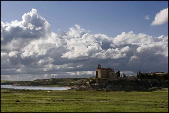
Upon leaving Montamarta, pilgrims cross a small medieval bridge and, after ascending to a high hill, encounter a monumental hermitage, the Virgen del Castillo Hermitage, an important point of interest on this stage.
What to See in Montamarta: History and Tradition
Hermitage of Nuestra Señora del Castillo
The Hermitage of Nuestra Señora del Castillo, built in the 16th century, is located next to one of the reservoirs of Ricobayo. On its north wall, there are Romanesque remains, such as corbels, dating from the early days of the hermitage. The building has a Renaissance style, and inside, a sculpture of the Virgin of Castillo, patroness of the town, is preserved.
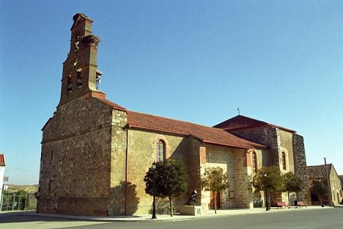
Church of San Miguel Arcángel
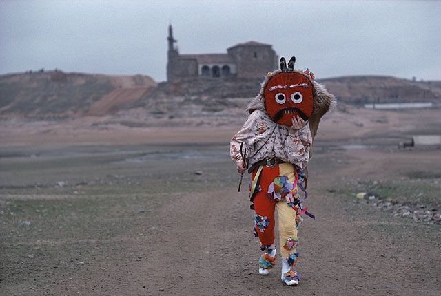
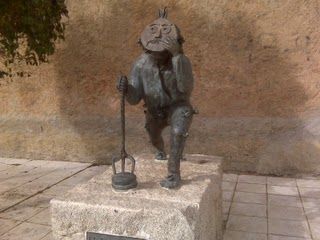
The Church of San Miguel Arcángel, also from the 16th century, is notable for its simple Romanesque baptismal font and a beautiful bell tower with a balcony, weather vane, and stork nests. In the church square, pilgrims can see a sculpture dedicated to the "Zangarrón," a character typical of local festivities. This figure, appearing in the New Year and Kings celebrations, roams the streets asking for alms that he places in his peculiar shirt.
Monastery of the Jerónimos
The Monastery of the Jerónimos, although only its main facade remains today, was once one of the most important religious sites in the region.
Rest Area in Montamarta
Municipal Picnic Area
Pilgrims can enjoy a well-deserved rest at the municipal picnic area in Montamarta, located in a poplar grove. The area is equipped with tables, benches, and a fountain, providing an ideal spot to relax and regain strength before continuing the route.
Stages
- VP01 Sevilla - Guillena , 22 km
- VP02 - Guillena - Castilblanco de los Arroyos - 19 km
- VP03 - Castilblanco de los Arroyos - Almadén de la Plata - 29,5 km
- VP04 - Almadén de la Plata-Monesterio - 34,5 km
- VP05 - Monesterio-Fuente de Cantos - 21,6 km
- VP06 - Fuente de Cantos - Zafra - 24,6 km
- VP07 - Zafra - Almendralejo - 36,7 km
- VP08 - Almendralejo - Mérida - 29,6 km
- VP09 - Mérida - Alcuéscar - 36 km
- VP10 - Alcuéscar - Valdesalor - 25,7 km
- VP11 - Valdesalor - Casar de Cáceres - 22,8 km
- VP12 - Casar de Cáceres - Cañaveral - 33,2 km
- VP13 - Cañaveral - Galisteo - 28 km
- VP14 - Galisteo - Cáparra - 29,5 km
- VP15 - Cáparra - Baños de Montemayor - 28,5 km
- VP16 - Baños de Montemayor - Fuenterroble de Salvatierra - 32,9 km
- VP17 - Fuenterroble de Salvatierra - San Pedro de Rozados - 28 km
- VP18 - San Pedro de Rozados - Salamanca - 23,4 km
- VP19 - Salamanca- El Cubo de la Tierra del Vino - 35 km
- VP20 - El Cubo de la Tierra del Vino - Zamora - 31,6 km
- VP21 - Zamora - Montamarta - 18,5 km
- VP22 - Montamarta - Granja de Moreruela - 22,7 km
- VP23 - Granja de Moreruela - Benavente - 25,5 km
- VP24 - Benavente - Alija del Infantado - 22,1 km
- VP25 - Alija del Infantado - La Bañeza - 20,5 km
- VP26 - La Bañeza - Astorga - 24,2 km