
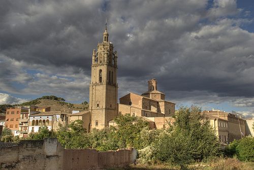
CF06 - Estella - Los Arcos - 20,6 km
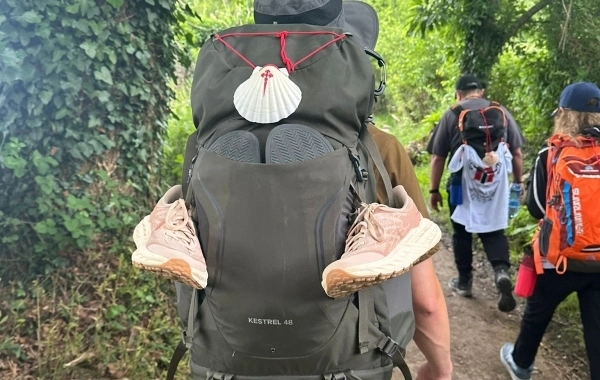
Distance21 Km.Related packages
Leaving Estella: Routes towards Azqueta
From Estella, the path follows the N-111 road towards Logroño. A few meters from the service station, the road is left behind on the right to enter the streets of Ayegui. From here, the pilgrim has two options:
Option A: Continue along the same side of the road, passing by the Irache Hotel, until reaching Azqueta.
Option B: Cross the N-111 road towards the Irache Wineries, where the Wine Fountain is located, installed in 1991. After enjoying this curious fountain, the path crosses the gardens of the Monastery of Nuestra Señora la Real de Irache, leaving the monastery behind. The route continues towards Azqueta, passing through an oak forest situated between Montejurra on the left and the N-111 road on the right.
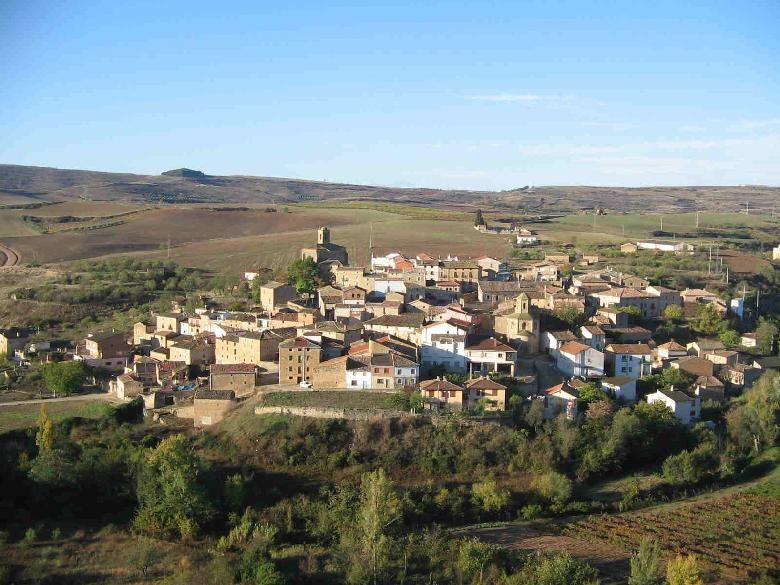
In both options, the visible landmark is the Azqueta settlement, located on a hill.
Towards Villamayor de Monjardín
Once in Azqueta, the path descends, passing a dairy farm on the right. The route continues along a path that crosses cereal fields and vineyards, reaching Villamayor de Monjardín after travelling just over 1 km. Before reaching the village, the Fuente de los Moros is passed on the right. From the hill that rises above Villamayor, the ruins of Monjardín Castle can be seen, dominating the landscape.
From Villamayor to Los Arcos: The Camino de la Soledad
From Villamayor de Monjardín, the path descends along an asphalted road towards the N-111, but without entering the road. On the right, a concentration track is taken, leading the pilgrim to Los Arcos, 12 km away.
This section of the Camino de Santiago is quite solitary, as there are no villages between Villamayor and Los Arcos. The route progresses along a wavy track between cereal fields and vineyards, crossing the areas of La Cañada, Cogullo, and Capanaldia. Along this stretch, a semi-abandoned corral is passed, and the path continues to border a slope covered in conifers. The route crosses a small stream, almost hidden among the reeds, before ascending slightly at the portillo de las Cabras. From here, the village of Los Arcos can already be seen, just a short distance away.
Stages
- CF01 - Saint Jean de Pied de Port - Roncesvalles - 21 km
- CF02 - Roncesvalles - Zubiri - 22 km
- CF03 - Zubiri - Pamplona - 20 km
- CF04 - Pamplona - Puente la Reina - 19 km
- CF05 - Puente la Reina - Estella - 19,7 km
- CF06 - Estella - Los Arcos - 20,6 km
- CF07 - Los Arcos - Viana - 18 km
- CF08 - Viana - Navarrete - 22,3 km
- CF09 - Navarrete - Nájera - 16,9 km
- CF10 - Nájera - Santo Domingo de la Calzada - 21 km
- CF11 - Santo Domingo de la Calzada - Belorado - 22,7 km
- CF12 - Belorado - San Juan de Ortega - 24 km
- CF13 - San Juan de Ortega - Burgos - 27,6 km
- CF14 - Burgos - Hornillos del Camino - 18,3 km
- CF15 - Hornillos del Camino - Castrojeriz - 20,40 km
- CF16 - Castrojeriz - Frómista - 24,90 km
- CF17 - Frómista - Carrión de los Condes - 19,2 km
- CF18 - Carrión de los Condes - Lédigos - 23,40 km
- CF19 - Lédigos - Sahagún - 17,10 km
- CF20 - Sahagún - El Burgo Ranero - 17,9 km
- CF21 - El Burgo Ranero - Mansilla de las Mulas - 18,7 km
- CF22 - Mansilla de las Mulas - León - 18,4 km
- CF23 - León - Villadangos del Páramo - 21,8 km
- CF24 - Villadangos del Páramo - Astorga - 26 km
- CF25 - Astorga - Rabanal del Camino - 20,6 km
- CF26 - Rabanal del Camino - Molinaseca - 24,7 km
- CF27 - Molinaseca - Villafranca del Bierzo - 30,5 km
- CF28 - Villafranca del Bierzo - O Cebreiro - 30 km
- CF29 - O Cebreiro - Triacastela - 22,9 km
- CF30 - Triacastela - Sarria - 22 km
- CF31 - Sarria - Portomarín - 22 km
- CF32 - Portomarín - Palas del Rei - 23,9 km
- CF33 - Palas del Rei - Arzúa - 28,6 km
- CF34 - Arzúa - Santiago de Compostela - 38,4 km
- CF35 - O Pedrouzo - Santiago de Compostela - 20 km